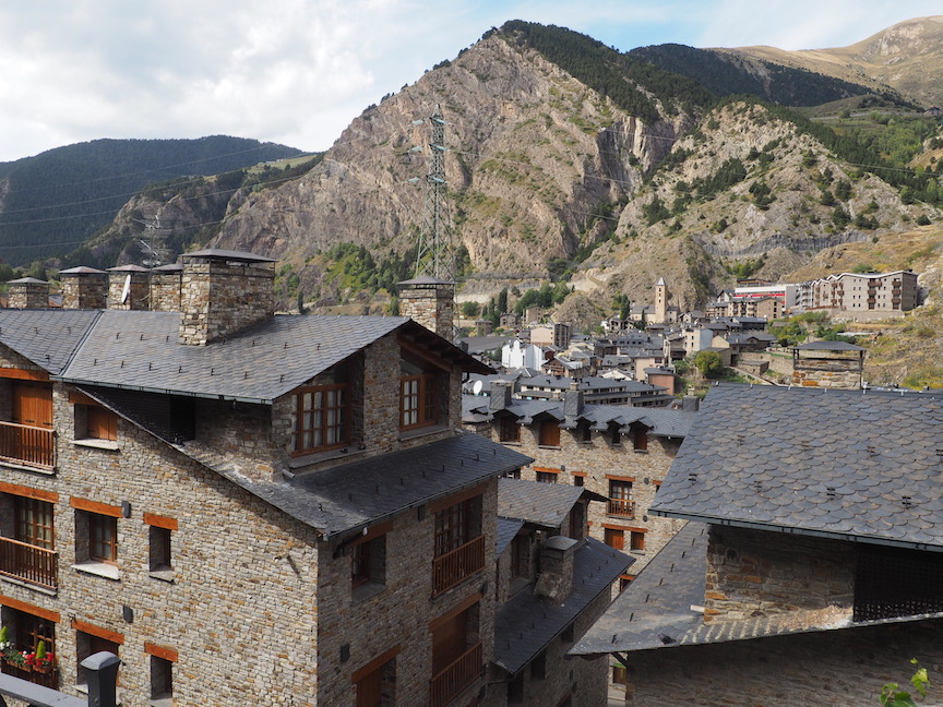
We want to explore more of Andorra. We can see from our balcony perch in the city that there is a major road leading out of town toward the French boarder. When it leaves our view, the road turns right sharply and then disappears into a notch in the mountains. The maps program shows little towns along the way. We decide to follow it.
We head out through the city using the GPS. It takes us through a series of turns and twist through town using many traffic circles along the way. The drivers are impatient in Andorra. As we have found, people with no place to go are in the biggest of hurries. It makes driving in town completely unpleasant, as cars and motor cycles fly by you in the most unnecessary moves, and in the most precarious ways. Making it worse, the crosswalk laws, that stop all cars for pedestrians, are strictly observed. Cars racing forward suddenly brake in front of you as a pedestrian casually steps into the busy traffic without care. Even though speeds are probably under 40 mph, it is still stressful driving about this unfamiliar city.
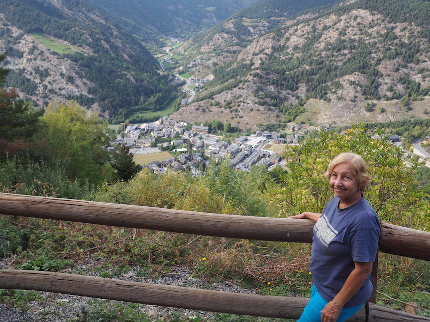
The road running to the next town, despite how it looked from our balcony, is completely commercial. The mountains and the forests drop down steeply to it, but at street level there are businesses and apartment buildings continuously along it. This goes on for several miles after we begin to rise out of Escaldes-Engordany. We pass through little towns of Encamp and Prats before eventually we make it to our goal Canillo. Canillo is supposed to have a church or monestary or something that Ana has found in a guide book. We can’t find it nor can we find any kind of town square. Ana is a little frustrated with me as I am not finding much to look at on this busy strip and she wants to accomplish something on our drive. I am getting nowhere with Canillo, so I make a U-turn and head back toward Escaldes-Engordany. Doing so we see a tourist sign that says Mirador, Spanish for view point. We decide to try it, why not?
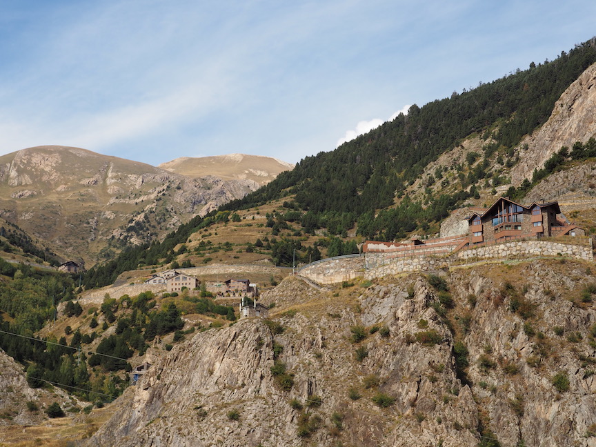
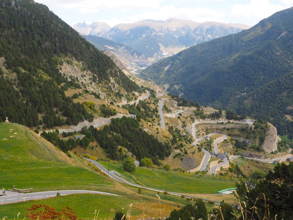
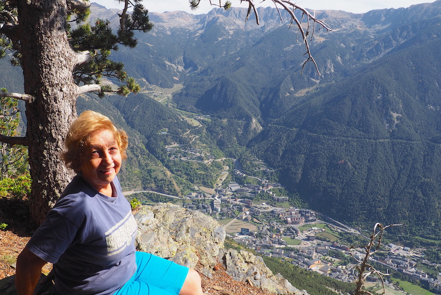
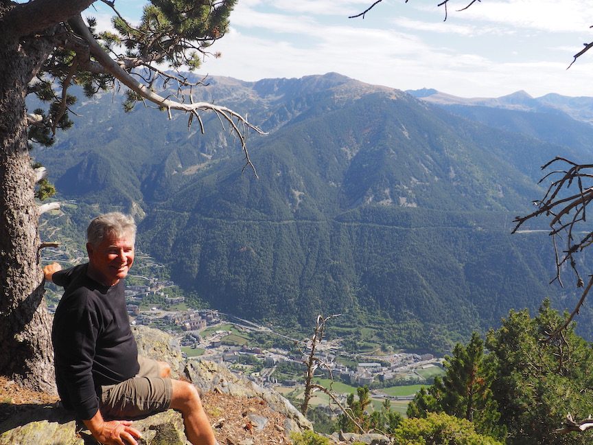
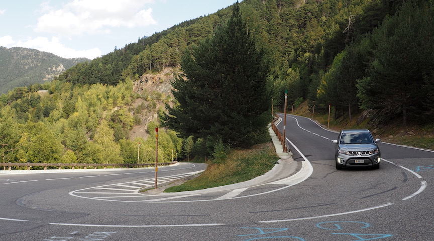
The road quickly rises past multi-story condo after condo for several switchbacks. It is a good road and we are heading up hill on the mountain quickly. Soon, we are leaving the town behind and far below. The road switchbacks with improbable sharp curves, always finding another path to go up the incredibly steep slope. Soon we are a thousand feet above Canillo and passing some homes perched among the trees just a few feet off the road and built completely on the cliff. To do this the homes have driveways that lead to garages on top of the house, the living quarters are on two stories below the garage. One simply drives off the road into a garage that parks the car in what we think of as the attic. These substantial places, the equivalent to an eagle’s nest, are obviously built by wealthy people with no fear of heights. Above these cliff dweller homes, we find find a precarious pull off and get our to look down. The the town of Canillo is now probably 2000 feet below us. It is difficult to walk to the edge of the pull off without summoning courage. We shoot a few shots that cannot capture the feeling we are experiencing. One foot on the edge, the other ready to step back to safety. Simply dizzying.
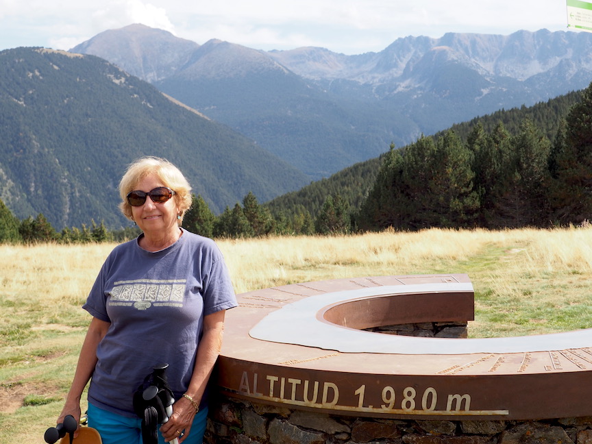
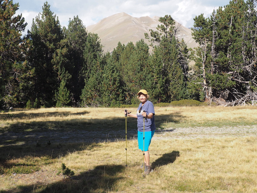
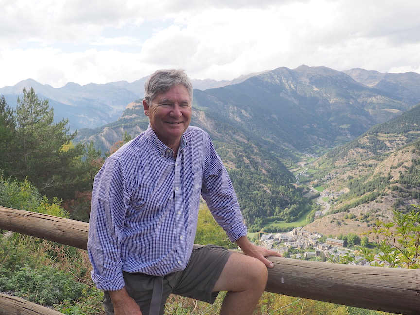
Back in the car, we expect the road to soon end at some good place to turn around. But it does not. It simply continues to climb upward rotating away from Canillo and deeper into the mountains. Soon, we are overlooking new valleys, some with small farms on hill sides where land has been terraced to plant. The road seems to be reaching a high point, where we find a large pull off with some hikers readying themselves for a walk. We shoot some photos, now more of the distant peaks than cliffs dropping below. We continue on and reach the pass. But before the road descends, there is another pull off with a few cars. From the parking area, we walk to the pasture and find a viewing station, a semi-circular table top, that points to the surrounding peaks naming them and indicating their altitude in meters. This info station sits at 1900 meters, about 6000 feet. There are nice views of majestic peaks rising above us, some over 9000 feet.
Ana wants to walk in this meadow and we don our hiking gear and gather up our walking poles. A sign says “Bony de la Neres” 45 minutes and points off into the forest across the meadow on a lane that starts to rise upward. I say we can always walk a while and then come back to the car. We are both tired of driving and sitting around. It is clear and sunny and surprisingly warm for the altitude. Off we go into the forest of Andorra and up a hill. Our soft grassy path soon turns to a dirt road which could be traveled by a jeep, but has no sign of any recent use. The road goes upward at a decent rate and we are feeling the altitude as we walk, getting quickly out of breath. Ana has not been feeling very well do to a medication she is taking so I am surprised how well she is doing on the trail. Her mountain genes have kicked in.
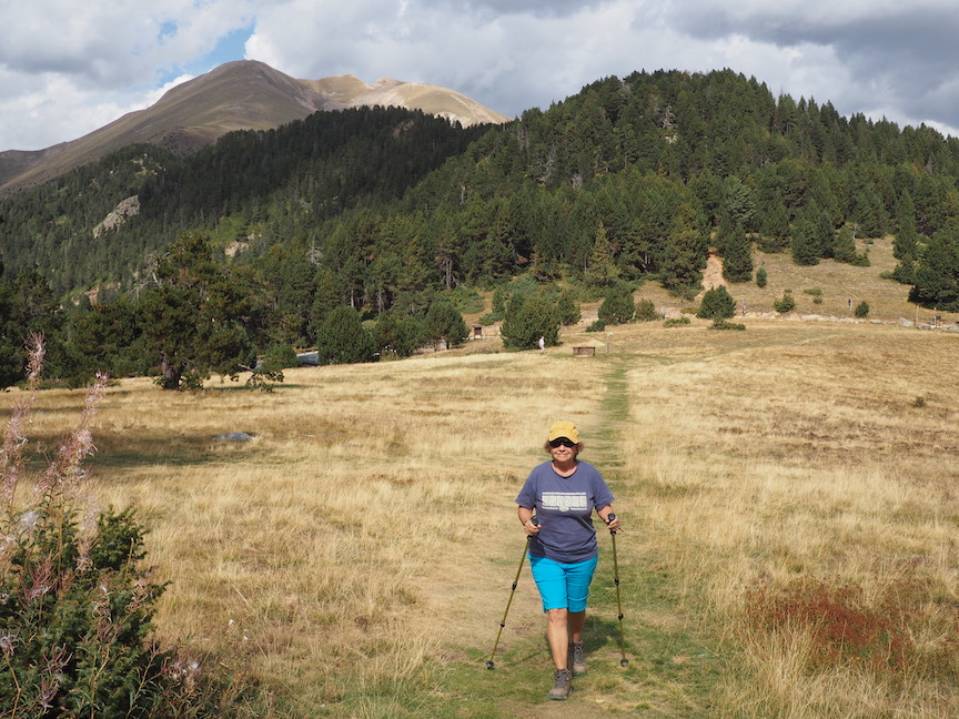
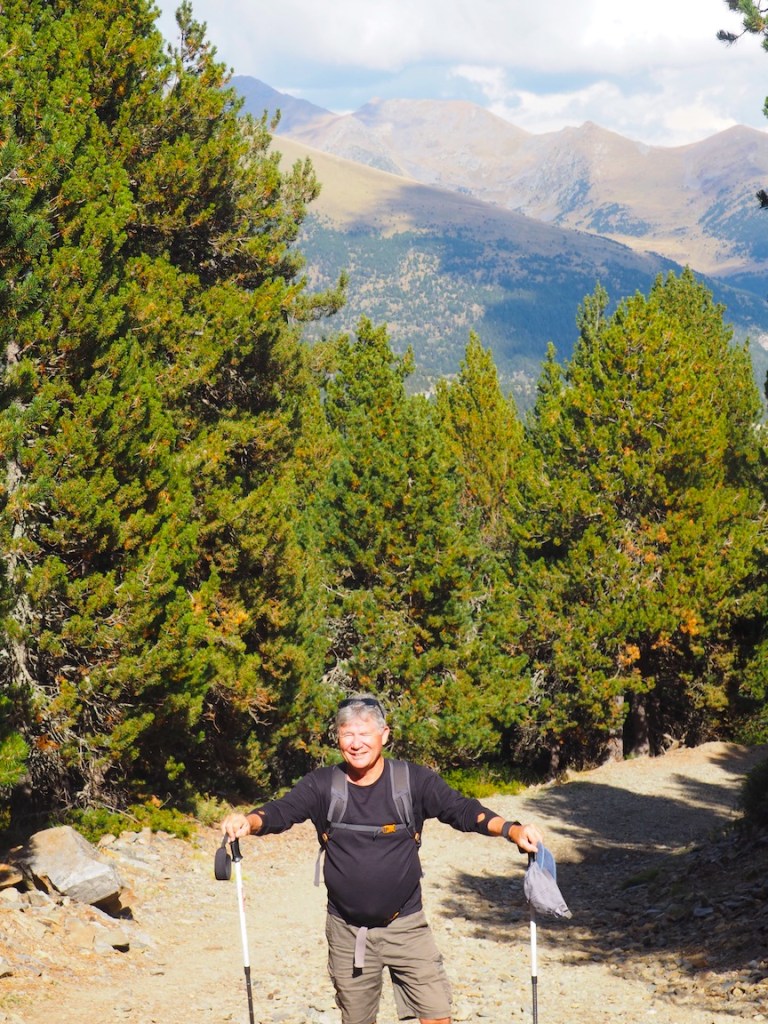
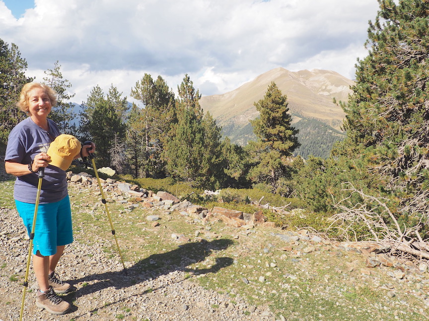
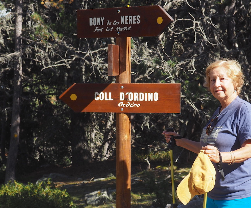
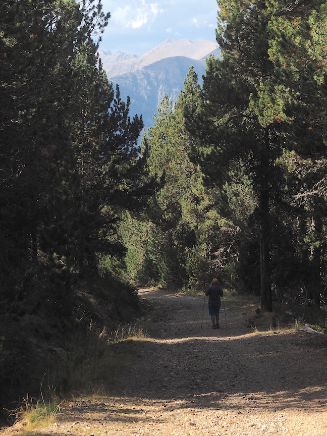
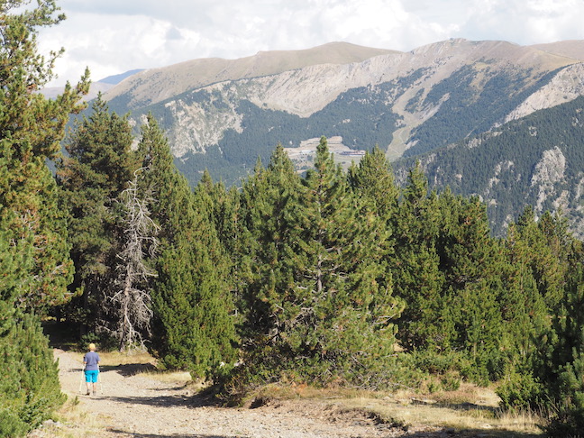
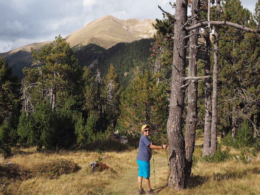
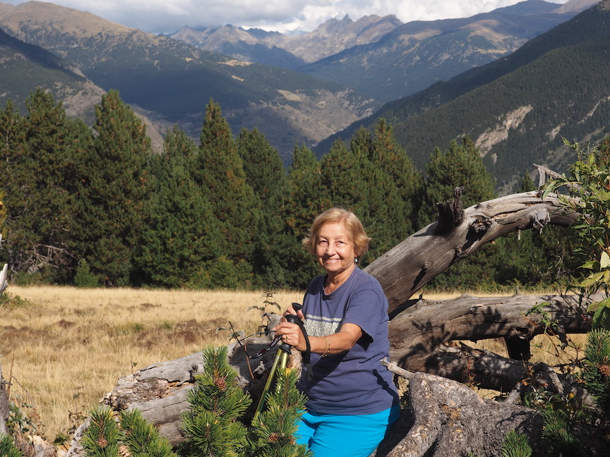
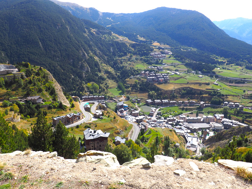
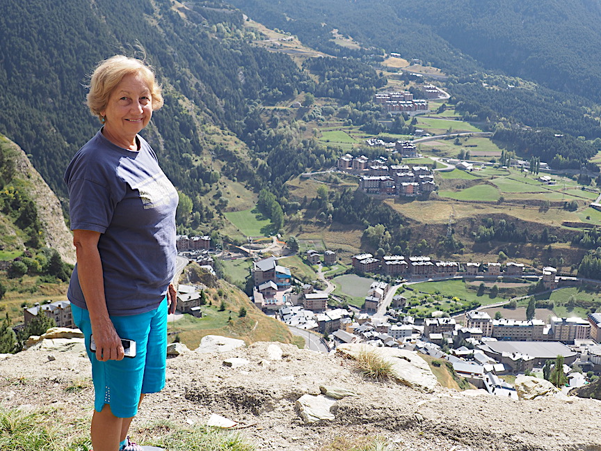
We walk up hill in the forest quite some time and my sense of this trail is that it is coming to a summit. We encounter a sign post indicating where we have come from and where the road could end up. We presume this trail will lead to another town somewhere downhill. I am not prepared to descend on this hike as it will mean walking back up to get to the car. But I feel at this point we can get to the top with a bit more effort. Ana has tired and wants to return. I negotiate with her that I will go a bit further on my own and call to her if the effort is worth making. She an follow at a slow pace until I see what is ahead. Light is showing through the trees, indicating the summit is coming and I push on. I come to a meadow as I go a bit higher and had some nice distant views from it of the surrounding peaks. I drop my pack to mark where I have left the road and call for Ana to keep coming. While she does, I walk across the meadow to its edge to see what is there. Soon I am looking down 7000 feet into the valley where Conillo sits. If I jumped I would not bounce for 1000 feet. A thrilling view downward, which I can only enjoy with one hand locked to the branch of a tree. Ana arrives and we shoot some photos marking our achievement. The hike has been a nice break in the day.
We walk back down and pass another couple likely our age. Ana wonders whether they will make it all the way up. I say they have boots and poles and even though the woman seems over dressed with gold chain about her neck, they probably will. We shoot a few more photos in this beautiful spot and then drive down the mountain road passing few cars until we reach Ordino and Massana, the towns we had visited the day before. Apparently we stumble upon a lonely mountain road linking the two places. It linked two busy commercial centers running through a wilderness. We are beginning to figure out Andorra.
The town of Ordino is Disneyesque. Most of it new but nicely crafted to look old with many houses made of stone. Phony as it seems to me, as we walk its up and down streets, I have to admit that it is pretty. We have stopped at a restaurant here for a 4 o’clock meal. We cannot get on Andorra time, Breakfast is at 7 a.m., lunch 2-3 p.m., restaurants closed 4-8 p.m., dinner 8-11 p.m. Our luncheon restaurant is not very good, just a weak excuse for tapas. They will not serve dinner until 8. Still, we get filled up and drive back to town. We make an attemp to walk from the parking lot to the main city that we have been viewing from above. Ana thinks shopping would be interestng. But half way down the city hill, we decide it will be too far up to walk back and don’t finish the attempt. Neither of us wants to drive into the busy town and look for a parking spot with the end of the day traffic swirling about. We’ll by a pizza near our condo and eat at the apartment to end this day.
